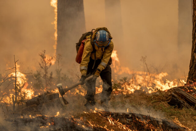
Wildfires on Western Slope Under Control Amid Weather Changes
Firefighting teams on the Western Slope have made tangible strides in containing multiple wildfires, thanks to a spell of cooler temperatures and cloud cover. However, an air-quality alert remains in effect until Saturday at 9 a.m. for the Mesa and Montrose counties as lingering smoke from the fires continues to impact air quality, according to Colorado’s health department. The National Weather Service in Grand Junction has warned that thunderstorms and gusty winds could also occur today, potentially leading to flash floods in burn scars and slot canyons.
South Rim Fire Update
The South Rim Fire, located within Black Canyon of the Gunnison National Park, is currently 14 percent contained. Operations Section Chief Tyler Nathe, representing the Rocky Mountain Area Complex Incident Management Team 3, expressed optimism about the fire’s containment efforts. He noted that several firebreaks established by bulldozers are proving effective, although surrounding vegetation remains highly susceptible to ignition.
This fire has caused significant damage within the park, impacting various facilities like the South Rim campground, bathrooms, and management buildings. All campground reservations and wilderness permits have been canceled indefinitely, as reported by the National Park Service. The current size of the fire stands at approximately 4,251 acres, or 6.6 square miles, but this figure may adjust as further aerial monitoring is conducted using infrared technology.
Turner Gulch Fire Developments
On the other side of Unaweep Canyon, the Turner Gulch fire continues to rage. Spanning an area of 15,286 acres, it is now 34 percent contained and remains the largest fire actively burning in Colorado. Chief Rob Powell of the Rocky Mountain Incident Team indicated that efforts were underway to return some evacuated residents home as early as today, pending discussions with the Mesa County sheriff’s office and state transportation officials.
The Mesa County sheriff’s office has eased evacuation status for private lands along Highway 141 between mile markers 120 and 134, advising residents to consult an interactive evacuation map for updated information. Fire crews are continuing to battle the blaze through rugged and steep terrain, with recent weather providing some assistance. Powell commented, “We kind of got a little bit of a break in the weather. Mother Nature’s always in charge, and she doesn’t have a heart.”
Wright Draw Fire Insights
Less extensive than the Turner Gulch Fire, the Wright Draw fire encompasses around 448 acres. While conditions appear favorable for suppression, Powell, remains cautious, stating, “We don’t trust it and the fuel type. Something squirrely could happen.”
Additional Fires Burning in the Region
Several other fires are also being monitored:
- Cottonwood Flat Fire: This brush fire has erupted on a county road between Rulison and Parachute, currently covering approximately 311 acres. Evacuations are in effect for residents within a one-mile radius of 1800 County Road 309.
- Sowbelly Fire: This fire is now around 24 percent contained and measures approximately 2,274 acres. The Bureau of Land Management is focused on establishing a secure perimeter around the blaze.
- Deer Creek Fire: Sizeable portions of this nearly 16,000-acre fire are also affecting Colorado near Paradox. A portion of the county’s western edge is currently under a pre-evacuation notice.
| Fire Name | Size (acres) | Containment (%) |
|---|---|---|
| South Rim Fire | 4,251 | 14% |
| Turner Gulch Fire | 15,286 | 34% |
| Wright Draw Fire | 448 | N/A |
| Cottonwood Flat Fire | 311 | N/A |
| Sowbelly Fire | 2,274 | 24% |
| Deer Creek Fire | 16,000 (total) | 11% |
As these fires continue to be monitored and tackled by brave firefighting crews, the combination of weather variability and smoke impact remains a key focus for local authorities and residents alike.


